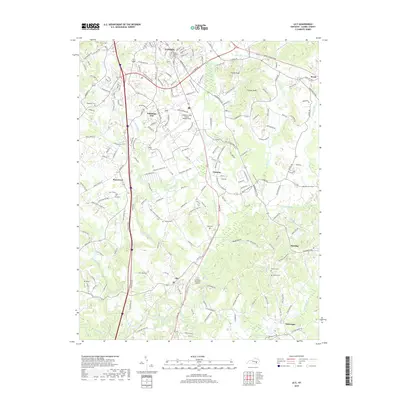
2019 Map of Lily
USGS Topo · Published 2019About this map
The Little Laurel River and Laurel River systems anchor the landscape south of London in Laurel County. This modern survey illustrates the suburban expansion and transportation corridors branching from the county seat, including the E Daniel Boone Pkwy and the heavy commercial infrastructure surrounding London-Corbin Airport-Magee Field. Smaller, historically distinct communities like Lily, Fariston, and Sublimity City maintain their identities amidst the transition from industrial and utility sites, such as the Sewage Disposal Plant Rd, to the more rural, creek-divided topography of the south and east. Genealogy researchers will find numerous family-named landmarks and burial sites, including the Owsley Cem, Hopkins Cem, and Ward Cem, alongside established local institutions like the Fariston Baptist Church. The terrain is characterized by prominent high points such as Rocky Knob and Frazier Knob, which overlook the winding tributaries of Rough Cr and Lick Cr.
Find a feature on this map
57 named features on this map. Tap any name to fly to it.
Don’t see what you’re looking for? This feature index may not catch every label — zoom into the map to look around manually.
Map Details
Editions of this 2019 Lily Map
This is the sole edition of this map. No revisions or reprints were ever made.
Other maps of this area

1886 · Cumberland Gap
USGS Topo · 1:125,000

1888 · Cumberland Gap
USGS Topo · 1:125,000

1890 · Williamsburg
USGS Topo · 1:125,000

1891 · Manchester
USGS Topo · 1:125,000

1891 · Cumberland Gap
USGS Topo · 1:125,000

1893 · London
USGS Topo · 1:125,000

1894 · Williamsburg
USGS Topo · 1:125,000

1897 · London
USGS Topo · 1:125,000

1952 · Portersburg
USGS Topo · 1:24,000

1952 · Corbin
USGS Topo · 1:24,000