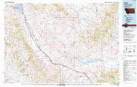
1987 Map of Lima
USGS Topo · Published 1987About this map
The Union Pacific railroad corridor and Interstate 15 define the human geography of this high-altitude landscape, following the path of the Red Rock River through the heart of Beaverhead County. The settlement of Lima serves as a central hub, flanked by the smaller stations of Dell and Monida, the latter perched near the Montana-Idaho state line. This 1987 map illustrates the transition from the wide Centennial Valley to the surrounding peaks of the Tendoy Mountains and Snowcrest Range.
Find a feature on this map
69 named features on this map. Tap any name to fly to it.
Don’t see what you’re looking for? This feature index may not catch every label — zoom into the map to look around manually.
Map Details
Editions of this 1987 Lima Map
This is the sole edition of this map. No revisions or reprints were ever made.
Other maps of this area

1888 · Three Forks
USGS Topo · 1:250,000

1893 · Dillon
USGS Topo · 1:250,000

1894 · Three Forks
USGS Topo · 1:250,000

1895 · Three Forks
USGS Topo · 1:250,000

1947 · Bozeman
USGS Topo · 1:250,000

1948 · Bozeman
USGS Topo · 1:250,000

1949 · Varney
USGS Topo · 1:62,500

1950 · Lower Red Rock Lake
USGS Topo · 1:62,500

1950 · Monument Ridge
USGS Topo · 1:62,500

1952 · Eli Spring
USGS Topo · 1:24,000