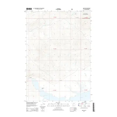
2014 Map of Lima Dam
USGS Topo · Published 2014About this map
Lima Dam and its expansive reservoir define the southern reach of this landscape, situated at the edge of the Centennial Valley. This 2014 survey captures a high-elevation transition where the valley floor meets the rising timber of the Beaverhead National Forest. The topography is marked by a complex network of drainage systems, including Little Basin Cr and Express Cr, which feed toward the reservoir from the surrounding highlands. Notable landmarks like the Clover Divide provide a structural barrier between the westward-flowing W Fork Blacktail Deer Cr and the waters flowing south. The road network is sparse, centered primarily on access routes like Lima Dam Rd and Antone Rd, reflecting the remote and managed nature of the forest and reclamation lands in Beaverhead County.
Find a feature on this map
18 named features on this map. Tap any name to fly to it.
Don’t see what you’re looking for? This feature index may not catch every label — zoom into the map to look around manually.
Map Details
Editions of this 2014 Lima Dam Map
This is the sole edition of this map. No revisions or reprints were ever made.
Other maps of this area

1955 · Dubois
USGS Topo · 1:250,000

1958 · Dubois
USGS Topo · 1:250,000

1968 · Corral Creek
USGS Topo · 1:24,000

1968 · Whiskey Spring
USGS Topo · 1:24,000

1968 · Lima Dam
USGS Topo · 1:24,000

1968 · Snowline
USGS Topo · 1:24,000

1968 · Vinegar Hill
USGS Topo · 1:24,000

1968 · Monida
USGS Topo · 1:24,000

1968 · Henry Gulch
USGS Topo · 1:24,000

1968 · Antone Peak
USGS Topo · 1:24,000