
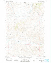
1968 Map of Henry Gulch
USGS Topo · Published 1972About this map
The Red Rock River meanders across the southern portion of this high-country landscape, serving as a primary drainage for the surrounding gulches and peaks of Beaverhead County. This late 1960s survey documents a territory defined by its hydrologic network and seasonal pastoral use, most notably indicated by the presence of Chris Cabin in the northern reaches near Basin Creek. The terrain is deeply incised by Henry Gulch and Centennial Gulch, which feed into the river system from the south.
Find a feature on this map
10 named features on this map. Tap any name to fly to it.
Don’t see what you’re looking for? This feature index may not catch every label — zoom into the map to look around manually.
Map Details
Editions of this 1968 Henry Gulch Map
2 editions found
Other maps of this area

1955 · Dubois
USGS Topo · 1:250,000

1958 · Dubois
USGS Topo · 1:250,000

1965 · Lima
USGS Topo · 1:24,000

1965 · Rock Island Ranch
USGS Topo · 1:24,000

1965 · Lima Peaks
USGS Topo · 1:24,000

1968 · Whiskey Spring
USGS Topo · 1:24,000

1968 · Lima Dam
USGS Topo · 1:24,000

1968 · Snowline
USGS Topo · 1:24,000

1968 · Vinegar Hill
USGS Topo · 1:24,000

1968 · Monida
USGS Topo · 1:24,000