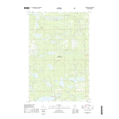
2019 Map of Lima Mountain
USGS Topo · Published 2019About this map
The Misquah Hills dominate this high-country landscape within the Superior National Forest, showcasing a complex glacial geography of ridges and interconnected waterways. The elevation peaks at Lima Mtn and Brule Mtn, while the South Brule River and its southern branch, the S Brule River, provide the primary drainage for dozens of named basins including Marshall Lake, Bower Trout Lake, and Abita Lake. This interior wilderness is accessed by a network of specialized routes, from the industrial-named The Grade in the south to the Expressway Route and the Kemo Lake Road Association paths. The density of smaller water bodies such as Rum Lake, Sled Lake, and Lullaby Lake highlights the remote nature of the terrain, where timber management and recreational forest use define the modern footprint of West Cook County.
Find a feature on this map
61 named features on this map. Tap any name to fly to it.
Don’t see what you’re looking for? This feature index may not catch every label — zoom into the map to look around manually.
Map Details
Editions of this 2019 Lima Mountain Map
This is the sole edition of this map. No revisions or reprints were ever made.
Other maps of this area

1919 · Brule Lake
USGS Topo · 1:62,500

1954 · Two Harbors
USGS Topo · 1:250,000

1957 · Two Harbors
USGS Topo · 1:250,000

1957 · Quetico
USGS Topo · 1:250,000

1958 · Two Harbors
USGS Topo · 1:250,000

1959 · Pine Mountain
USGS Topo · 1:24,000

1959 · Lima Mountain
USGS Topo · 1:24,000

1959 · Hungry Jack Lake
USGS Topo · 1:24,000

1959 · Crocodile Lake
USGS Topo · 1:24,000

1960 · Grand Marais
USGS Topo · 1:24,000