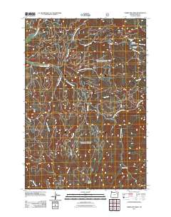
2011 Map of Limber Jim Creek
USGS Topo · Published 2011About this map
The Grande Ronde River flows through this portion of the Blue Mountains, creating a complex drainage system characterized by the East Fork Grande Ronde River and numerous high-country meadows. The landscape is defined by the three forks of its namesake waterway: Limber Jim Creek, North Fork Limber Jim Creek, and South Fork Limber Jim Creek. These streams converge amidst a series of alpine clearings, most notably Limber Jim Meadow and the expansive Round Meadow to the south.
Find a feature on this map
17 named features on this map. Tap any name to fly to it.
Don’t see what you’re looking for? This feature index may not catch every label — zoom into the map to look around manually.
Map Details
Editions of this 2011 Limber Jim Creek Map
This is the sole edition of this map. No revisions or reprints were ever made.
Other maps of this area

1901 · Sumpter
USGS Topo · 1:125,000

1953 · Pendleton
USGS Topo · 1:250,000

1955 · Canyon City
USGS Topo · 1:250,000

1956 · Pendleton
USGS Topo · 1:250,000

1959 · Canyon City
USGS Topo · 1:250,000

1965 · Limber Jim Creek
USGS Topo · 1:24,000

1965 · Marley Creek
USGS Topo · 1:24,000

1965 · Anthony Butte
USGS Topo · 1:24,000

1965 · Little Beaver Creek
USGS Topo · 1:24,000
1965 · La Grande Reservoir
USGS Topo · 1:24,000