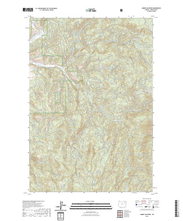
2023 Map of Limber Jim Creek
USGS Topo · Published 2023About this map
The Grande Ronde River and its intricate tributaries dominate this high-elevation landscape within the Whitman National Forest. The topography is defined by the steep transition from the Limber Jim Ridge down into deep drainage basins, where the North Fork Limber Jim Creek and South Fork Limber Jim Creek converge. Historically used for seasonal grazing and timber management, the area features namesake clearings like Limber Jim Meadow and Round Meadow that stand out against the densely forested slopes of the Elkhorn Mountains.
Find a feature on this map
30 named features on this map. Tap any name to fly to it.
Don’t see what you’re looking for? This feature index may not catch every label — zoom into the map to look around manually.
Map Details
Editions of this 2023 Limber Jim Creek Map
This is the sole edition of this map. No revisions or reprints were ever made.
Other maps of this area

1901 · Sumpter
USGS Topo · 1:125,000

1953 · Pendleton
USGS Topo · 1:250,000

1955 · Canyon City
USGS Topo · 1:250,000

1956 · Pendleton
USGS Topo · 1:250,000

1959 · Canyon City
USGS Topo · 1:250,000

1965 · Limber Jim Creek
USGS Topo · 1:24,000

1965 · Marley Creek
USGS Topo · 1:24,000

1965 · Anthony Butte
USGS Topo · 1:24,000

1965 · Little Beaver Creek
USGS Topo · 1:24,000
1965 · La Grande Reservoir
USGS Topo · 1:24,000