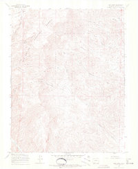
1967 Map of Lime Creek
USGS Topo · Published 1970About this map
Rio Grande National Forest dominates this landscape, showing a region defined by high-altitude drainages and resource extraction in the late 1960s. The terrain is deeply incised by North Fork Carnero Creek and Cottonwood Creek, with water sources like Little Cottonwood Creek and Spring providing vital points in the arid surroundings. The presence of a designated Stock Driveway through the center of the sheet indicates the importance of seasonal livestock movement between grazing lands, a hallmark of the regional ranching economy.
Find a feature on this map
18 named features on this map. Tap any name to fly to it.
Don’t see what you’re looking for? This feature index may not catch every label — zoom into the map to look around manually.
Map Details
Editions of this 1967 Lime Creek Map
3 editions found
Other maps of this area

1915 · Del Norte
USGS Topo · 1:125,000

1917 · Del Norte
USGS Topo · 1:125,000

1945 · Durango
USGS Topo · 1:250,000

1953 · Durango
USGS Topo · 1:250,000

1954 · Durango
USGS Topo · 1:250,000

1956 · Montrose
USGS Topo · 1:250,000

1959 · Montrose
USGS Topo · 1:250,000

1960 · Montrose
USGS Topo · 1:250,000

1961 · Durango
USGS Topo · 1:250,000

1963 · Durango
USGS Topo · 1:250,000