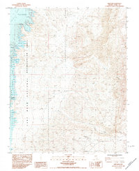
1983 Map of Lime Wash
USGS Topo · Published 1984About this map
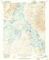
The Virgin River meets the northern reaches of the Overton Arm in this survey of the desert landscape north of Lake Mead. This region within the Lake Mead National Recreation Area is defined by its dramatic shoreline and drainage systems, where the arid topography is carved by Lime Wash and Quail Wash. The map documents a transition point between the river's path and the rising reservoir waters, noting specific aquatic features such as Kline Hole and the curiously named Glory Hole near the river's entrance to the lake.
Find a feature on this map
16 named features on this map. Tap any name to fly to it.
Don’t see what you’re looking for? This feature index may not catch every label — zoom into the map to look around manually.
Map Details
Editions of this 1983 Lime Wash Map
2 editions found

Other maps of this area

1886 · Saint Thomas
USGS Topo · 1:250,000

1893 · Saint Thomas
USGS Topo · 1:250,000

1926 · Bonelli
USGS Topo · 1:96,000
1953 · Overton Beach
USGS Topo · 1:62,500
1953 · Iceberg Canyon
USGS Topo · 1:62,500
1953 · Gold Butte
USGS Topo · 1:62,500
1953 · Virgin Basin
USGS Topo · 1:62,500

1954 · Las Vegas
USGS Topo · 1:250,000

1957 · Las Vegas
USGS Topo · 1:250,000

1959 · Las Vegas
USGS Topo · 1:250,000