
1983 Map of Lime Wash
USGS Topo · Published 1986About this map
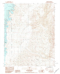
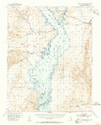
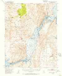
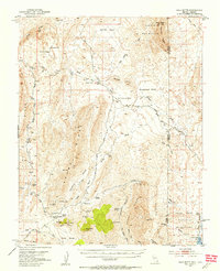
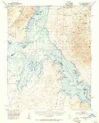
Lake Mead National Recreation Area dominates the western portion of this 1980s-era landscape, where the Virgin River meets the northern reaches of the reservoir's Overton Arm. The map captures a transition between the inundated topography of the lake and the dry, high-elevation desert terrain to the east. Names like Lime Cove and Submarine Point mark the modern shoreline, while inland features such as Kline Hole and Glory Hole suggest a legacy of local landmarks near the river's original path.
Find a feature on this map
17 named features on this map. Tap any name to fly to it.
Don’t see what you’re looking for? This feature index may not catch every label — zoom into the map to look around manually.
Map Details
Editions of this 1983 Lime Wash Map
2 editions found
Other maps of this area

1886 · Saint Thomas
USGS Topo · 1:250,000

1893 · Saint Thomas
USGS Topo · 1:250,000

1926 · Bonelli
USGS Topo · 1:96,000
1953 · Overton Beach
USGS Topo · 1:62,500
1953 · Iceberg Canyon
USGS Topo · 1:62,500
1953 · Gold Butte
USGS Topo · 1:62,500
1953 · Virgin Basin
USGS Topo · 1:62,500

1954 · Las Vegas
USGS Topo · 1:250,000

1957 · Las Vegas
USGS Topo · 1:250,000

1959 · Las Vegas
USGS Topo · 1:250,000