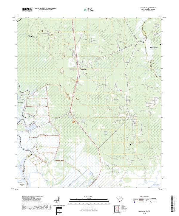
2024 Map of Limehouse
USGS Topo · Published 2024About this map
Savannah National Wildlife Refuge dominates the western portion of this Lowcountry landscape, where the Georgia-South Carolina border follows the winding course of the Little Back River and Back River. This coastal environment is defined by an intricate network of waterways including the New River, Wright River, and the Murray Hill Canal, reflecting the region's historic reliance on water for transportation and agriculture. Settled pockets like Limehouse, Levy, and Tunbridge Neck are scattered among expansive wetlands and swamps such as Monkey John Swamp and Mile Swamp.
Find a feature on this map
80 named features on this map. Tap any name to fly to it.
Don’t see what you’re looking for? This feature index may not catch every label — zoom into the map to look around manually.
Map Details
Editions of this 2024 Limehouse Map
This is the sole edition of this map. No revisions or reprints were ever made.
Other maps of this area

1920 · Hardeeville
USGS Topo · 1:62,500

1920 · Okatie
USGS Topo · 1:62,500

1920 · Bluffton
USGS Topo · 1:62,500

1942 · Savannah
USGS Topo · 1:62,500

1942 · Okatie
USGS Topo · 1:62,500

1943 · Hardeeville
USGS Topo · 1:62,500

1945 · Bluffton
USGS Topo · 1:62,500

1947 · Savannah
USGS Topo · 1:250,000

1948 · Savannah
USGS Topo · 1:250,000

1953 · Hardeeville
USGS Topo · 1:62,500