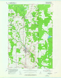
1953 Map of Limestone
USGS Topo · Published 1955About this map
Limestone serves as the hub of this Aroostook County landscape during the early 1950s, a period marked by significant military development along the international border. The western portion of the map is dominated by the sprawling U S Military Reservation Loring Air Force Base, which significantly altered the local topography and road networks of Caswell Plantation. The town center shows a compact cluster of commerce and residences near Limestone Pond, where the Bangor and Aroostook railroad line curves through the valley.
Find a feature on this map
56 named features on this map. Tap any name to fly to it.
Don’t see what you’re looking for? This feature index may not catch every label — zoom into the map to look around manually.
Map Details
Editions of this 1953 Limestone Map
2 editions found
Other maps of this area

1921 · Van Buren
USGS Topo · 1:250,000

1930 · Fort Fairfield
USGS Topo · 1:48,000

1931 · Van Buren
USGS Topo · 1:48,000

1933 · Fort Fairfield
USGS Topo · 1:62,500

1934 · Van Buren
USGS Topo · 1:62,500

1951 · Van Buren
USGS Topo · 1:62,500

1951 · Fort Fairfield
USGS Topo · 1:62,500

1953 · Fort Fairfield NW
USGS Topo · 1:24,000

1959 · Woodstock
USGS Topo · 1:250,000
1963 · Campbellton
USGS Topo · 1:250,000