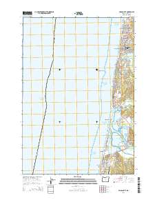
2014 Map of Lincoln City
USGS Topo · Published 2014About this map
Lincoln City serves as the central hub of this coastal stretch, where the city limits encompass a series of once-distinct communities along the Pacific Ocean. This survey shows the tightly packed residential street grids of Wecoma Beach, Oceanlake, Delake, and Nelscott as they interface with the Oregon Coast Hwy. The landscape is defined by the significant transition from the freshwater Devils Lake in the north to the tidal environment of Siletz Bay in the south, protected by the Salishan Spit. Further south, the map documents the more secluded residential patterns of Salishan and Gleneden Beach. Key local landmarks include the Taft Cem and Josephine Young Memorial Park, while the Siletz Bay State Airport and Millport Slough anchor the southern reaches of the quadrangle near the Siletz River.
Find a feature on this map
31 named features on this map. Tap any name to fly to it.
Don’t see what you’re looking for? This feature index may not catch every label — zoom into the map to look around manually.
Map Details
Editions of this 2014 Lincoln City Map
This is the sole edition of this map. No revisions or reprints were ever made.
Other maps of this area

1941 · Nestucca Bay
USGS Topo · 1:62,500

1941 · Cape Foulweather
USGS Topo · 1:62,500

1942 · Euchre Mtn
USGS Topo · 1:62,500

1942 · Nestucca Bay
USGS Topo · 1:62,500

1943 · Euchre Mtn
USGS Topo · 1:62,500

1944 · Cape Foulweather
USGS Topo · 1:62,500

1948 · Vancouver
USGS Topo · 1:250,000

1950 · Vancouver
USGS Topo · 1:250,000

1950 · Vancouver
USGS Topo · 1:250,000

1953 · Salem
USGS Topo · 1:250,000