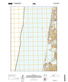
2020 Map of Lincoln City
USGS Topo · Published 2020About this map
Lincoln City and its constituent coastal communities are documented here at the edge of the Pacific Ocean. The map reveals the intricate string of settlements along the shoreline, including Wecoma Beach, Oceanlake, Delake, Nelscott, Taft, and Cutler City, reflecting the mid-20th-century consolidation of these distinct beach towns. The geography is dominated by the narrow Salishan Spit, which separates the ocean from the waters of Siletz Bay. Inland, Devils Lake sits just east of the northern town centers, while further south, the Siletz River winds toward the coast near Kernville. Transportation and utility infrastructure like the Siletz Bay State Airport and the local road network, including SE East Devils Lake Rd and S Schooner Creek Rd, highlight the area's development. Notable landmarks such as Taft Cem and Josephine Young Memorial Park provide specific points of reference for local historians and genealogists tracking family roots in this part of Lincoln County.
Find a feature on this map
71 named features on this map. Tap any name to fly to it.
Don’t see what you’re looking for? This feature index may not catch every label — zoom into the map to look around manually.
Map Details
Editions of this 2020 Lincoln City Map
This is the sole edition of this map. No revisions or reprints were ever made.
Other maps of this area

1941 · Nestucca Bay
USGS Topo · 1:62,500

1941 · Cape Foulweather
USGS Topo · 1:62,500

1942 · Euchre Mtn
USGS Topo · 1:62,500

1942 · Nestucca Bay
USGS Topo · 1:62,500

1943 · Euchre Mtn
USGS Topo · 1:62,500

1944 · Cape Foulweather
USGS Topo · 1:62,500

1948 · Vancouver
USGS Topo · 1:250,000

1950 · Vancouver
USGS Topo · 1:250,000

1950 · Vancouver
USGS Topo · 1:250,000

1953 · Salem
USGS Topo · 1:250,000