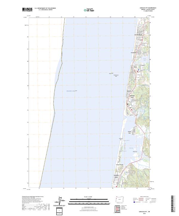
2024 Map of Lincoln City
USGS Topo · Published 2024About this map
Lincoln City anchors this coastal survey, reflecting its 20th-century consolidation of several distinct oceanfront communities. The map captures the linear settlement pattern along the shoreline, where Wecoma Beach, Oceanlake, Delake, Nelscott, Taft, and Cutler City maintain their local identities while forming a continuous urban corridor. This concentration of development is bounded by the Pacific Ocean to the west and the freshwater Devils Lake and rising terrain to the east, creating a narrow habitable shelf that defines the area's geography.
Find a feature on this map
71 named features on this map. Tap any name to fly to it.
Don’t see what you’re looking for? This feature index may not catch every label — zoom into the map to look around manually.
Map Details
Editions of this 2024 Lincoln City Map
This is the sole edition of this map. No revisions or reprints were ever made.
Other maps of this area

1941 · Nestucca Bay
USGS Topo · 1:62,500

1941 · Cape Foulweather
USGS Topo · 1:62,500

1942 · Euchre Mtn
USGS Topo · 1:62,500

1942 · Nestucca Bay
USGS Topo · 1:62,500

1943 · Euchre Mtn
USGS Topo · 1:62,500

1944 · Cape Foulweather
USGS Topo · 1:62,500

1948 · Vancouver
USGS Topo · 1:250,000

1950 · Vancouver
USGS Topo · 1:250,000

1950 · Vancouver
USGS Topo · 1:250,000

1953 · Salem
USGS Topo · 1:250,000