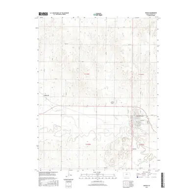
2016 Map of Lincoln
USGS Topo · Published 2016About this map
The Saline River meanders through the heart of Lincoln County, defining a landscape of riparian corridors and upland divides. This mid-2010s survey captures the regional hub of Lincoln Center, where a grid of streets like E Lincoln Ave and E School St centers around local civic life. To the west, the settlement of Goldenrod sits along the section lines, reflecting the enduring township-and-range organization of the Kansas plains.
Find a feature on this map
28 named features on this map. Tap any name to fly to it.
Don’t see what you’re looking for? This feature index may not catch every label — zoom into the map to look around manually.
Map Details
Editions of this 2016 Lincoln Map
This is the sole edition of this map. No revisions or reprints were ever made.
Other maps of this area

1894 · Ellsworth
USGS Topo · 1:125,000

1894 · Beloit
USGS Topo · 1:125,000

1955 · Great Bend
USGS Topo · 1:250,000

1955 · Beloit
USGS Topo · 1:250,000

1957 · Great Bend
USGS Topo · 1:250,000

1958 · Great Bend
USGS Topo · 1:250,000

1959 · Beloit
USGS Topo · 1:250,000

1962 · Vesper
USGS Topo · 1:24,000

1962 · Lincoln
USGS Topo · 1:24,000
1963 · Shady Bend
USGS Topo · 1:24,000