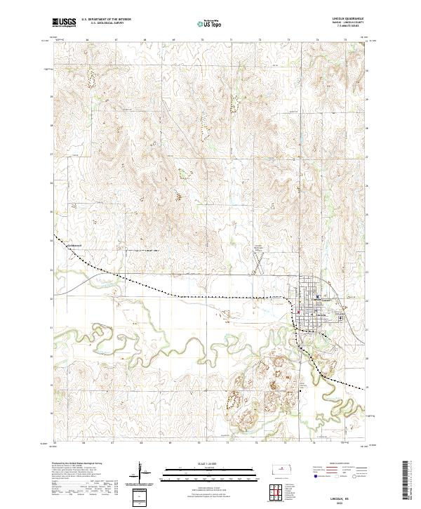
2022 Map of Lincoln
USGS Topo · Published 2022About this map
The Saline River meanders across this Central Kansas landscape, anchoring a network of tributaries that includes Spillman Cr, Lost Cr, and Bullfoot Cr. The settlement of Lincoln Center serves as the regional hub, defined by its historic grid including E Lincoln Ave and W North St. Significant civic landmarks such as the Lincoln County Courthouse and the nearby Lincoln Municipal Airport reflect the town's established infrastructure.
Find a feature on this map
52 named features on this map. Tap any name to fly to it.
Don’t see what you’re looking for? This feature index may not catch every label — zoom into the map to look around manually.
Map Details
Editions of this 2022 Lincoln Map
This is the sole edition of this map. No revisions or reprints were ever made.
Other maps of this area

1894 · Ellsworth
USGS Topo · 1:125,000

1894 · Beloit
USGS Topo · 1:125,000

1955 · Great Bend
USGS Topo · 1:250,000

1955 · Beloit
USGS Topo · 1:250,000

1957 · Great Bend
USGS Topo · 1:250,000

1958 · Great Bend
USGS Topo · 1:250,000

1959 · Beloit
USGS Topo · 1:250,000

1962 · Vesper
USGS Topo · 1:24,000

1962 · Lincoln
USGS Topo · 1:24,000
1963 · Shady Bend
USGS Topo · 1:24,000