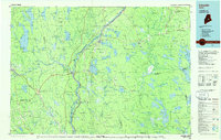
1986 Map of Lincoln
USGS Topo · Published 1986About this map
The Penobscot River and its major tributaries, including the Piscataquis River and Mattawamkeag River, define the industrial and transport geography of this mid-1980s Penobscot County landscape. Settlement clusters such as Lincoln, Howland, and Milo are closely tied to these waterways and the accompanying rail corridors. Three major railroads—the Maine Central, Bangor and Aroostook, and Canadian Pacific—intersect the region, supporting the timber and manufacturing heritage of towns like Derby and Lincoln Center.
Find a feature on this map
156 named features on this map. Tap any name to fly to it.
Don’t see what you’re looking for? This feature index may not catch every label — zoom into the map to look around manually.
Map Details
Editions of this 1986 Lincoln Map
This is the sole edition of this map. No revisions or reprints were ever made.
Other maps of this area

1902 · Orono
USGS Topo · 1:62,500

1902 · Bangor
USGS Topo · 1:62,500

1917 · Passadumkeag
USGS Topo · 1:62,500

1920 · Winn
USGS Topo · 1:62,500

1929 · Great Pond
USGS Topo · 1:48,000

1929 · Lead Mountain
USGS Topo · 1:48,000

1931 · Springfield
USGS Topo · 1:48,000

1931 · Stetson
USGS Topo · 1:48,000

1931 · Saponac
USGS Topo · 1:48,000

1932 · Dover-Foxcroft
USGS Topo · 1:48,000