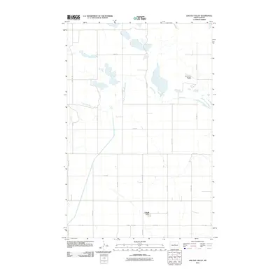
2011 Map of Lincoln Valley
USGS Topo · Published 2011About this map
The Lincoln Valley settlement anchors the southern portion of this Sheridan County landscape, where the prairie is organized by a precise grid of rural roads such as 15th St NE and 11th Ave NE. To the north, the Sheyenne River meanders through the terrain, its course marked by several small lakes and wetland depressions typical of the region's glacial history. This 2011 survey reflects the agricultural and aviation character of the area, notably featuring the Petes Tractor Salvage Airport located east of the river. The map details the local transportation network that connects remote farmsteads to the valley, including County Hwy 4216, which serves as a primary east-west corridor for the community.
Find a feature on this map
18 named features on this map. Tap any name to fly to it.
Don’t see what you’re looking for? This feature index may not catch every label — zoom into the map to look around manually.
Map Details
Editions of this 2011 Lincoln Valley Map
This is the sole edition of this map. No revisions or reprints were ever made.
Other maps of this area

1930 · Drake
USGS Topo · 1:62,500

1940 · Aylmer
USGS Topo · 1:62,500

1946 · Sheyenne Lake
USGS Topo · 1:48,000

1947 · Lincoln Valley
USGS Topo · 1:62,500

1947 · Sheyenne Lake
USGS Topo · 1:62,500

1950 · Sheyenne Lake
USGS Topo · 1:24,000

1951 · Anamoose SW
USGS Topo · 1:24,000

1954 · McClusky
USGS Topo · 1:250,000

1958 · McClusky
USGS Topo · 1:250,000

1958 · Drake
USGS Topo · 1:62,500