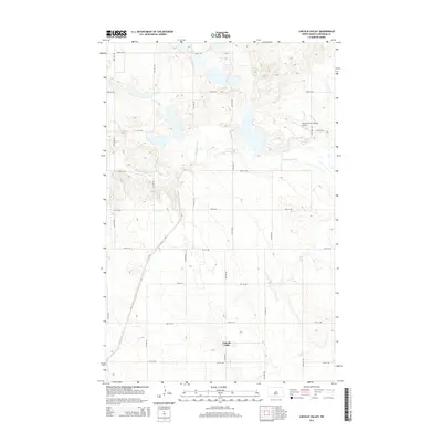
2014 Map of Lincoln Valley
USGS Topo · Published 2014About this map
Lincoln Valley serves as the primary point of interest in this central North Dakota landscape, situated within a grid of section-line roads typical of the Great Plains. The headwaters region of the Sheyenne River meanders through the northern half of the territory, creating a natural break in the agricultural layout of numbered avenues and streets. A unique aviation landmark, Pete's Tractor Salvage Airport, is located east of the river, reflecting the region's intersection of rural industry and local transport. The terrain is defined by low-lying wetlands and small basins scattered across the prairie, particularly between 22nd St NE and 23rd St NE, illustrating the drainage patterns that feed into the river system.
Find a feature on this map
20 named features on this map. Tap any name to fly to it.
Don’t see what you’re looking for? This feature index may not catch every label — zoom into the map to look around manually.
Map Details
Editions of this 2014 Lincoln Valley Map
This is the sole edition of this map. No revisions or reprints were ever made.
Other maps of this area

1930 · Drake
USGS Topo · 1:62,500

1940 · Aylmer
USGS Topo · 1:62,500

1946 · Sheyenne Lake
USGS Topo · 1:48,000

1947 · Lincoln Valley
USGS Topo · 1:62,500

1947 · Sheyenne Lake
USGS Topo · 1:62,500

1950 · Sheyenne Lake
USGS Topo · 1:24,000

1951 · Anamoose SW
USGS Topo · 1:24,000

1954 · McClusky
USGS Topo · 1:250,000

1958 · McClusky
USGS Topo · 1:250,000

1958 · Drake
USGS Topo · 1:62,500