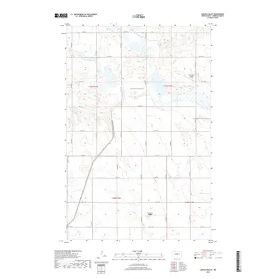
2018 Map of Lincoln Valley
USGS Topo · Published 2018About this map
Lincoln Valley remains the primary settlement in this Sheridan County landscape, where the prairie is defined by a complex network of seasonal wetlands and glacial depressions. The terrain is marked by the upper reaches of the Sheyenne River, which meanders through the central portion of the quadrangle. A unique modern landmark, Pete's Tractor Salvage Airport, sits in the northeast quadrant, reflecting the region's agricultural-industrial character. The N Country National Scenic Trail winds through the area, following the natural contours of the land and providing a cross-section of the local geography. This 2018 survey reveals a systematic grid of section roads, including 12th Ave NE and 17th St NE, that provide access to the dispersed farmsteads and agricultural plots that sustain this North Dakota community.
Find a feature on this map
25 named features on this map. Tap any name to fly to it.
Don’t see what you’re looking for? This feature index may not catch every label — zoom into the map to look around manually.
Map Details
Editions of this 2018 Lincoln Valley Map
This is the sole edition of this map. No revisions or reprints were ever made.
Other maps of this area

1930 · Drake
USGS Topo · 1:62,500

1940 · Aylmer
USGS Topo · 1:62,500

1946 · Sheyenne Lake
USGS Topo · 1:48,000

1947 · Lincoln Valley
USGS Topo · 1:62,500

1947 · Sheyenne Lake
USGS Topo · 1:62,500

1950 · Sheyenne Lake
USGS Topo · 1:24,000

1951 · Anamoose SW
USGS Topo · 1:24,000

1954 · McClusky
USGS Topo · 1:250,000

1958 · McClusky
USGS Topo · 1:250,000

1958 · Drake
USGS Topo · 1:62,500