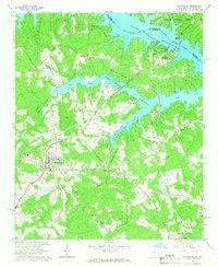
1964 Map of Lincolnton
USGS Topo · Published 1966About this map
The Lincolnton town site serves as the focal point of this mid-1960s survey, situated west of the expansive Clark Hill Reservoir. This era of development is defined by the transformation of the Savannah River valley into a massive reservoir system, where the rising waters of Soap Creek and Dry Fork Creek have created a complex, fingered shoreline. The infrastructure reflects a community in transition, balancing the new recreational economy of Soap Creek Lodge and Augusta Camp with established rural foundations like the Training Sch and High Sch.
Find a feature on this map
35 named features on this map. Tap any name to fly to it.
Don’t see what you’re looking for? This feature index may not catch every label — zoom into the map to look around manually.
Map Details
Editions of this 1964 Lincolnton Map
2 editions found
Other maps of this area

1892 · Mc Cormick
USGS Topo · 1:125,000

1906 · Crawfordville
USGS Topo · 1:125,000

1912 · Mc Cormick
USGS Topo · 1:125,000

1921 · Appling
USGS Topo · 1:62,500

1943 · Appling
USGS Topo · 1:62,500

1953 · Athens
USGS Topo · 1:250,000

1954 · Metasville
USGS Topo · 1:24,000

1955 · Chennault
USGS Topo · 1:24,000

1958 · Athens
USGS Topo · 1:250,000

1959 · Athens
USGS Topo · 1:250,000