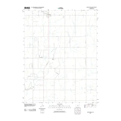
2009 Map of Lincolnville
USGS Topo · Published 2009About this map
The settlement of Lincolnville sits at the intersection of a grid-iron road network and the primary north-south artery of Lincolnville Ave, serving as the central hub for this portion of Marion County. To the northwest of the town center lies the Lincolnville Cemetery, a key site for local genealogical research. The landscape is defined by the drainage of several waterways, including East Branch Clear Creek, Clear Creek, and Turkey Creek, which weave through the agricultural sections of the quadrangle. An industrial footprint is evident near the center of the sheet at the Lost Creek Oil and Gas Field, indicating the importance of energy extraction alongside traditional farming. Further south, the community of Antelope and rural landmarks such as Wagonwheel Rd provide further context for the mid-2000s settlement patterns and infrastructure of the Kansas prairie.
Find a feature on this map
27 named features on this map. Tap any name to fly to it.
Don’t see what you’re looking for? This feature index may not catch every label — zoom into the map to look around manually.
Map Details
Editions of this 2009 Lincolnville Map
This is the sole edition of this map. No revisions or reprints were ever made.
Other maps of this area

1889 · Newton
USGS Topo · 1:125,000

1889 · Abilene
USGS Topo · 1:125,000

1889 · Parkerville
USGS Topo · 1:125,000

1894 · Newton
USGS Topo · 1:125,000

1894 · Abilene
USGS Topo · 1:125,000

1894 · Parkerville
USGS Topo · 1:125,000

1898 · Cottonwood Falls
USGS Topo · 1:125,000

1955 · Hutchinson
USGS Topo · 1:250,000

1957 · Cedar Point
USGS Topo · 1:24,000

1957 · Lincolnville SW
USGS Topo · 1:24,000