
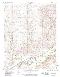
1957 Map of Cedar Point
USGS Topo · Published 1958About this map
Cedar Point sits at the confluence of the Cottonwood River and Cedar Creek, serving as a focal point for the surrounding prairie landscape in the late 1950s. The region is defined by its deep agricultural and genealogical roots, evidenced by several family-named burial grounds like Montgomery Cem, Drinkwater Cem, and Pinkston Cem. These sites, alongside the Immanuel Ch, reflect the established community structure of the Marion and Chase borderlands.
Find a feature on this map
17 named features on this map. Tap any name to fly to it.
Don’t see what you’re looking for? This feature index may not catch every label — zoom into the map to look around manually.
Map Details
Editions of this 1957 Cedar Point Map
2 editions found
Other maps of this area

1898 · Cottonwood Falls
USGS Topo · 1:125,000

1955 · Hutchinson
USGS Topo · 1:250,000

1957 · Elmdale
USGS Topo · 1:24,000

1957 · Florence
USGS Topo · 1:24,000

1957 · Wonsevu
USGS Topo · 1:24,000

1957 · Lincolnville SW
USGS Topo · 1:24,000

1957 · Hymer
USGS Topo · 1:24,000

1959 · Hutchinson
USGS Topo · 1:250,000

1970 · Lincolnville NE
USGS Topo · 1:24,000
1971 · Lincolnville
USGS Topo · 1:24,000