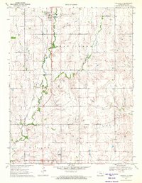
1971 Map of Lincolnville
USGS Topo · Published 1972About this map
Lincolnville stands at the northern edge of this Marion County landscape, serving as a primary hub for the surrounding agricultural plains in the early 1970s. The town's infrastructure is clearly detailed, including the Sewage Disposal Ponds and a nearby Roadside Park along Highway 77. Running south from the town, the Chicago Rock Island and Pacific railroad forms a straight spine through the prairie, passing the small settlement of Antelope and providing a vital transport link for local grain and goods.
Find a feature on this map
19 named features on this map. Tap any name to fly to it.
Don’t see what you’re looking for? This feature index may not catch every label — zoom into the map to look around manually.
Map Details
Editions of this 1971 Lincolnville Map
This is the sole edition of this map. No revisions or reprints were ever made.
Other maps of this area

1889 · Newton
USGS Topo · 1:125,000

1889 · Abilene
USGS Topo · 1:125,000

1889 · Parkerville
USGS Topo · 1:125,000

1894 · Newton
USGS Topo · 1:125,000

1894 · Abilene
USGS Topo · 1:125,000

1894 · Parkerville
USGS Topo · 1:125,000

1898 · Cottonwood Falls
USGS Topo · 1:125,000

1955 · Hutchinson
USGS Topo · 1:250,000

1957 · Cedar Point
USGS Topo · 1:24,000

1957 · Lincolnville SW
USGS Topo · 1:24,000