
1957 Map of Florence
USGS Topo · Published 1958About this map
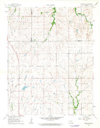
Florence stands at the confluence of the Cottonwood River and Doyle Creek, serving as a vital rail hub in the late 1950s. The town's grid is dense with landmarks including Grandview Park and a central Water Tank, while the surrounding landscape is marked by the heavy infrastructure of the Santa Fe and Atchison Topeka lines. Beyond the town center, the map reveals a rural community supported by isolated schoolhouses and churches, such as School No 51 and Summit Ch. Evidence of early petroleum exploration appears via scattered Oil Wells across the Summit and Doyle regions. The terrain transitions from river bottomlands to higher ground, where a notable Railroad Grade and family-named water sources like Lee Spring define the property boundaries and local geography of Marion County.
Find a feature on this map
26 named features on this map. Tap any name to fly to it.
Don’t see what you’re looking for? This feature index may not catch every label — zoom into the map to look around manually.
Map Details
Editions of this 1957 Florence Map
This is the sole edition of this map. No revisions or reprints were ever made.
Other maps of this area

1889 · Newton
USGS Topo · 1:125,000

1894 · Newton
USGS Topo · 1:125,000

1898 · Cottonwood Falls
USGS Topo · 1:125,000

1955 · Hutchinson
USGS Topo · 1:250,000

1957 · Wonsevu
USGS Topo · 1:24,000

1957 · Cedar Point
USGS Topo · 1:24,000

1957 · Lincolnville SW
USGS Topo · 1:24,000

1957 · Peabody
USGS Topo · 1:24,000

1959 · Hutchinson
USGS Topo · 1:250,000
1962 · Florence SE
USGS Topo · 1:24,000