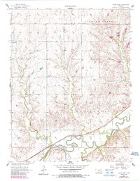
1957 Map of Cedar Point
USGS Topo · Published 1985About this map
Cottonwood River and the Atchison Topeka and Santa Fe railroad corridor define the southern landscape of this Kansas quadrangle. The settlement of Cedar Point serves as the primary focal point, situated at the confluence where several waterways meet the river valley. The map reveals a rural structure characterized by family and community landmarks, including the Drinkwater Cem near the town site and the Montgomery Cem further north.
Find a feature on this map
18 named features on this map. Tap any name to fly to it.
Don’t see what you’re looking for? This feature index may not catch every label — zoom into the map to look around manually.
Map Details
Editions of this 1957 Cedar Point Map
2 editions found
Other maps of this area

1898 · Cottonwood Falls
USGS Topo · 1:125,000

1955 · Hutchinson
USGS Topo · 1:250,000

1957 · Elmdale
USGS Topo · 1:24,000

1957 · Florence
USGS Topo · 1:24,000

1957 · Wonsevu
USGS Topo · 1:24,000

1957 · Cedar Point
USGS Topo · 1:24,000

1957 · Lincolnville SW
USGS Topo · 1:24,000

1957 · Hymer
USGS Topo · 1:24,000

1959 · Hutchinson
USGS Topo · 1:250,000

1970 · Lincolnville NE
USGS Topo · 1:24,000