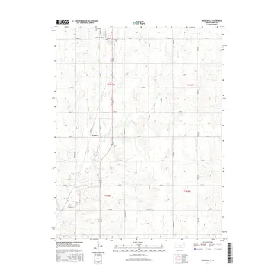
2015 Map of Lincolnville
USGS Topo · Published 2015About this map
The settlement of Lincolnville and the small community of Antelope define the human geography of this rural Kansas landscape. Located along Lincolnville Ave, the town of Lincolnville serves as a local hub with its Po and the Lincolnville Cem situated to the north. The area is characterized by a precise grid of section roads, including Yarrow Rd and Zebulon Rd, which overlay a prairie terrain carved by several waterways. The drainage patterns of Clear Cr, its E Br Clear Cr, and Martin Cr create the subtle topographic variations that break the geometric regularity of the farmland. This survey captures the enduring agricultural structure of Marion County, where township lines like t18s r4e and t19s r4e still dictate the placement of farmsteads and transport routes.
Find a feature on this map
34 named features on this map. Tap any name to fly to it.
Don’t see what you’re looking for? This feature index may not catch every label — zoom into the map to look around manually.
Map Details
Editions of this 2015 Lincolnville Map
This is the sole edition of this map. No revisions or reprints were ever made.
Other maps of this area

1889 · Newton
USGS Topo · 1:125,000

1889 · Abilene
USGS Topo · 1:125,000

1889 · Parkerville
USGS Topo · 1:125,000

1894 · Newton
USGS Topo · 1:125,000

1894 · Abilene
USGS Topo · 1:125,000

1894 · Parkerville
USGS Topo · 1:125,000

1898 · Cottonwood Falls
USGS Topo · 1:125,000

1955 · Hutchinson
USGS Topo · 1:250,000

1957 · Cedar Point
USGS Topo · 1:24,000

1957 · Lincolnville SW
USGS Topo · 1:24,000