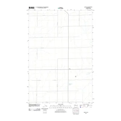
2011 Map of Lind SE
USGS Topo · Published 2011About this map
Delight Cemetery and the ephemeral drainage of McChesney Spring anchor this agricultural landscape in Adams County. This 2011 survey illustrates the grid-based rural infrastructure that supports the region's dryland farming, where north-south corridors like S Longmeier Rd and S Seivers Rd segment the open country. To the east, the terrain transitions into the Sand Hills, a distinct geographical break from the surrounding plateau. The map captures the continuity of local landholdings through named routes such as E Cunningham Rd and E Sutton Rd, reflecting the heritage of the families who settled this portion of eastern Washington.
Find a feature on this map
13 named features on this map. Tap any name to fly to it.
Don’t see what you’re looking for? This feature index may not catch every label — zoom into the map to look around manually.
Map Details
Editions of this 2011 Lind SE Map
This is the sole edition of this map. No revisions or reprints were ever made.
Other maps of this area

1916 · Connell
USGS Topo · 1:125,000

1918 · Connell
USGS Topo · 1:125,000

1923 · Washtucna
USGS Topo · 1:62,500

1925 · Washtucna
USGS Topo · 1:62,500

1948 · Ayer
USGS Topo · 1:62,500

1950 · Haas
USGS Topo · 1:62,500

1953 · Walla Walla
USGS Topo · 1:250,000

1958 · Walla Walla
USGS Topo · 1:250,000

1970 · Lind SE
USGS Topo · 1:24,000

1970 · Lind SW
USGS Topo · 1:24,000