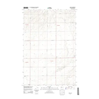
2014 Map of Lind SE
USGS Topo · Published 2014About this map
Michigan Prairie and the undulating Sand Hills dominate this portion of the Columbia Plateau, where dryland farming and a geometric road grid define the landscape. This 2014 survey captures a rural expanse of southeastern Washington characterized by the presence of McChesney Spring and the Sand Hills Coulee in the south. The intersection of Wa-26 and Wa-21 serves as a modern transportation axis for the region. Longstanding local landmarks persist amidst the agricultural sections, most notably the Delight Cem located along the highway. Named local routes such as Wahl Rd and S Longmeier Rd trace the property boundaries and section lines that have organized this territory since the era of original settlement and the development of the Inland Empire's wheat-growing country.
Find a feature on this map
23 named features on this map. Tap any name to fly to it.
Don’t see what you’re looking for? This feature index may not catch every label — zoom into the map to look around manually.
Map Details
Editions of this 2014 Lind SE Map
This is the sole edition of this map. No revisions or reprints were ever made.
Other maps of this area

1916 · Connell
USGS Topo · 1:125,000

1918 · Connell
USGS Topo · 1:125,000

1923 · Washtucna
USGS Topo · 1:62,500

1925 · Washtucna
USGS Topo · 1:62,500

1948 · Ayer
USGS Topo · 1:62,500

1950 · Haas
USGS Topo · 1:62,500

1953 · Walla Walla
USGS Topo · 1:250,000

1958 · Walla Walla
USGS Topo · 1:250,000

1970 · Lind SE
USGS Topo · 1:24,000

1970 · Lind SW
USGS Topo · 1:24,000