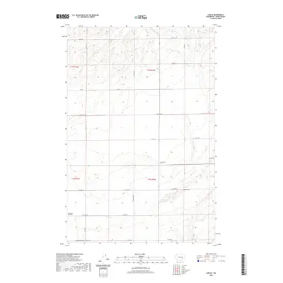
2020 Map of Lind SE
USGS Topo · Published 2020About this map
Michigan Prairie and the undulating Sand Hills dominate this portion of Adams County, where the landscape is etched by a network of rural section-line roads and natural drainages. The area is characterized by dryland agricultural patterns and the distinct geological features of the Sand Hills Coulee in the south. Local history is anchored by the presence of the Delight Cem and McChesney Spring, which suggest the locations of early homesteads and watering points in an otherwise arid stretch of the Columbia Basin. A grid of roads named for local families, such as Sutton Rd, Wahl Rd, and Yeisley Rd, provides a clear view of the modern land divisions and access routes across these townships.
Find a feature on this map
22 named features on this map. Tap any name to fly to it.
Don’t see what you’re looking for? This feature index may not catch every label — zoom into the map to look around manually.
Map Details
Editions of this 2020 Lind SE Map
This is the sole edition of this map. No revisions or reprints were ever made.
Other maps of this area

1916 · Connell
USGS Topo · 1:125,000

1918 · Connell
USGS Topo · 1:125,000

1923 · Washtucna
USGS Topo · 1:62,500

1925 · Washtucna
USGS Topo · 1:62,500

1948 · Ayer
USGS Topo · 1:62,500

1950 · Haas
USGS Topo · 1:62,500

1953 · Walla Walla
USGS Topo · 1:250,000

1958 · Walla Walla
USGS Topo · 1:250,000

1970 · Lind SE
USGS Topo · 1:24,000

1970 · Lind SW
USGS Topo · 1:24,000