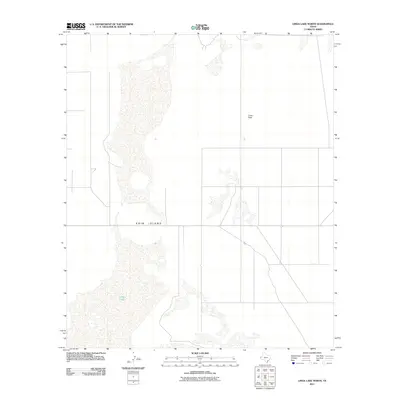
2011 Map of Linda Lake North
USGS Topo · Published 2011About this map
Linda Lake dominates the southern landscape of this Hudspeth County quadrangle, situated within the expansive basin of Crow Flats. This arid region of West Texas is characterized by ephemeral water bodies and isolated landforms like Erin Island, which rises as a distinct feature within the lakebed. The map reveals a highly structured grid of local roads and property boundaries that cross the desert floor, reflecting the organized ranching and land management practices of the early 21st century. The sparse distribution of named features emphasizes the remote, wide-open nature of this landscape near the New Mexico border, where topography is defined more by subtle shifts in elevation and intermittent drainage patterns than by dense settlement.
Find a feature on this map
3 named features on this map. Tap any name to fly to it.
Don’t see what you’re looking for? This feature index may not catch every label — zoom into the map to look around manually.
Map Details
Editions of this 2011 Linda Lake North Map
This is the sole edition of this map. No revisions or reprints were ever made.
Other maps of this area

1933 · Guadalupe Peak
USGS Topo · 1:48,000

1935 · El Paso Gap
USGS Topo · 1:62,500

1936 · El Paso Gap
USGS Topo · 1:48,000

1940 · El Paso Gap
USGS Topo · 1:62,500

1940 · Guadalupe Peak
USGS Topo · 1:62,500

1951 · Dell City
USGS Topo · 1:62,500

1954 · Carlsbad
USGS Topo · 1:250,000

1954 · Van Horn
USGS Topo · 1:250,000

1958 · Van Horn
USGS Topo · 1:250,000

1958 · Carlsbad
USGS Topo · 1:250,000