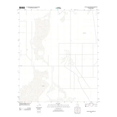
2012 Map of Linda Lake North
USGS Topo · Published 2012About this map
The arid landscape of Hudspeth County is defined by the sweeping reach of the Salt Basin, which dominates the western half of this area. This saline playa system creates a distinctive topography where water occasionally accumulates, leaving behind salt deposits that have influenced the local environment for centuries. In the northern reaches, Crow Spring provides a rare and vital water source within the broader Crow Flats region. The settlement pattern is minimal, consisting of a sparse grid of local tracks and the passage of Williams Rd at the southern end. This survey effectively documents the intersection of vast natural alkali basins and the tenuous human infrastructure established to navigate the Trans-Pecos desert.
Find a feature on this map
4 named features on this map. Tap any name to fly to it.
Don’t see what you’re looking for? This feature index may not catch every label — zoom into the map to look around manually.
Map Details
Editions of this 2012 Linda Lake North Map
This is the sole edition of this map. No revisions or reprints were ever made.
Other maps of this area

1933 · Guadalupe Peak
USGS Topo · 1:48,000

1935 · El Paso Gap
USGS Topo · 1:62,500

1936 · El Paso Gap
USGS Topo · 1:48,000

1940 · El Paso Gap
USGS Topo · 1:62,500

1940 · Guadalupe Peak
USGS Topo · 1:62,500

1951 · Dell City
USGS Topo · 1:62,500

1954 · Carlsbad
USGS Topo · 1:250,000

1954 · Van Horn
USGS Topo · 1:250,000

1958 · Van Horn
USGS Topo · 1:250,000

1958 · Carlsbad
USGS Topo · 1:250,000