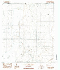
1984 Map of Linda Lake North
USGS Topo · Published 1985About this map
Linda Lake and the surrounding arid landscape of Hudspeth County define this West Texas border region in the early 1980s. Straddling the New Mexico Texas state line, the terrain is characterized by a series of ephemeral water features and expansive evaporative beds, including the Alkali Lakes and Flats. The map captures a transition where the desert floor breaks into distinct topographic markers such as Erin Island and the broad Basin.
Find a feature on this map
14 named features on this map. Tap any name to fly to it.
Don’t see what you’re looking for? This feature index may not catch every label — zoom into the map to look around manually.
Map Details
Editions of this 1984 Linda Lake North Map
This is the sole edition of this map. No revisions or reprints were ever made.
Other maps of this area

1933 · Guadalupe Peak
USGS Topo · 1:48,000

1935 · El Paso Gap
USGS Topo · 1:62,500

1936 · El Paso Gap
USGS Topo · 1:48,000

1940 · El Paso Gap
USGS Topo · 1:62,500

1940 · Guadalupe Peak
USGS Topo · 1:62,500

1951 · Dell City
USGS Topo · 1:62,500

1954 · Carlsbad
USGS Topo · 1:250,000

1954 · Van Horn
USGS Topo · 1:250,000

1958 · Van Horn
USGS Topo · 1:250,000

1958 · Carlsbad
USGS Topo · 1:250,000