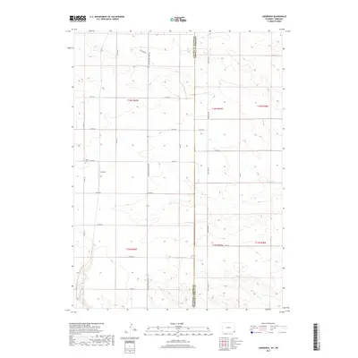
2017 Map of Lindbergh
USGS Topo · Published 2017About this map
Lindbergh sits at the heart of this High Plains landscape, where the high-altitude terrain of Laramie County meet the Nebraska border. The map illustrates a strictly organized agricultural grid, dominated by a network of county roads like Co Rd 161 and Co Rd 222 that follow the section lines of the Public Land Survey System. Historical traces are preserved at the Salem Cem, a local landmark that serves as a focal point for genealogical interest in this sparsely populated region. The importance of regional transit is evident in the long north-south corridor of Pine Bluffs Albin Rd, which connects the small settlement of Lindbergh to the surrounding farming communities. Straddling the state line, the map shows how the border between Wyoming and Nebraska is defined by State Line Rd, carving a precise vertical boundary through the rolling prairie.
Find a feature on this map
27 named features on this map. Tap any name to fly to it.
Don’t see what you’re looking for? This feature index may not catch every label — zoom into the map to look around manually.
Map Details
Editions of this 2017 Lindbergh Map
This is the sole edition of this map. No revisions or reprints were ever made.
Other maps of this area

1954 · Scottsbluff
USGS Topo · 1:250,000

1954 · Cheyenne
USGS Topo · 1:250,000

1958 · Cheyenne
USGS Topo · 1:250,000

1958 · Scottsbluff
USGS Topo · 1:250,000

1963 · Pine Bluffs
USGS Topo · 1:24,000

1963 · Lindbergh
USGS Topo · 1:24,000

1963 · Gurney Peak
USGS Topo · 1:24,000

1963 · Tracy
USGS Topo · 1:24,000

1968 · Pine Bluffs
USGS Topo · 1:24,000

1972 · Bushnell
USGS Topo · 1:24,000