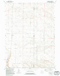
1991 Map of Lindbergh
USGS Topo · Published 1995About this map
Wyoming and Nebraska meet along a straight meridian on this High Plains survey, where the landscape is defined by the high, flat-topped Bushnell plateau. This region is characterized by sparse settlement and a grid of rural roads that cross the State Line between Laramie County and Kimball County. The small community of Lindbergh serves as a primary local landmark, anchored by the Lindbergh Cem to its north. Further south, the settlement of Russell sits near the base of the upland terrain. The presence of a Gravel Pit near the border suggests the local importance of aggregate extraction in an area otherwise dominated by open range and dryland agricultural patterns typical of the late twentieth-century borderlands.
Find a feature on this map
8 named features on this map. Tap any name to fly to it.
Don’t see what you’re looking for? This feature index may not catch every label — zoom into the map to look around manually.
Map Details
Editions of this 1991 Lindbergh Map
This is the sole edition of this map. No revisions or reprints were ever made.
Other maps of this area

1954 · Scottsbluff
USGS Topo · 1:250,000

1954 · Cheyenne
USGS Topo · 1:250,000

1958 · Cheyenne
USGS Topo · 1:250,000

1958 · Scottsbluff
USGS Topo · 1:250,000

1963 · Pine Bluffs
USGS Topo · 1:24,000

1963 · Lindbergh
USGS Topo · 1:24,000

1963 · Gurney Peak
USGS Topo · 1:24,000

1963 · Tracy
USGS Topo · 1:24,000

1968 · Pine Bluffs
USGS Topo · 1:24,000

1972 · Bushnell
USGS Topo · 1:24,000