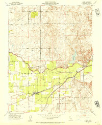
1953 Map of Linden
USGS Topo · Published 1954About this map
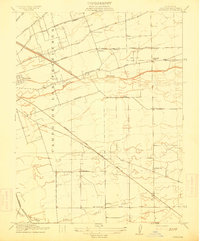
Linden serves as the focal point of this Central Valley landscape, situated at a junction of agriculture and irrigation just after the mid-century. The settlement is defined by its local institutions, including a Cemetery and High School, supporting a rural population connected by the Eastern and Terminal Railroad. The terrain is shaped by an intricate water system, where the Mokelumne River and Calaveras River traverse the region alongside the Kettleman Aqueduct. This survey captures the transition from traditional river-and-slough drainage to a more engineered agricultural environment, evidenced by the presence of a significant Reservoir and the managed flow of Mormon Slough. Scattered schoolhouses like Grant Sch and Moore School indicate the distributed nature of the community before the major consolidation of the late 20th century.
Find a feature on this map
28 named features on this map. Tap any name to fly to it.
Don’t see what you’re looking for? This feature index may not catch every label — zoom into the map to look around manually.
Map Details
Editions of this 1953 Linden Map
This is the sole edition of this map. No revisions or reprints were ever made.
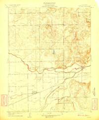
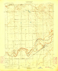
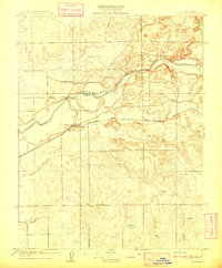
Other maps of this area

1889 · Jackson
USGS Topo · 1:125,000

1892 · Jackson
USGS Topo · 1:125,000

1894 · Lodi
USGS Topo · 1:125,000

1897 · Jackson
USGS Topo · 1:125,000

1902 · Jackson
USGS Topo · 1:125,000

1908 · Waterloo
USGS Topo · 1:31,680
1908 · Linden
USGS Topo · 1:31,680
1908 · Lockeford
USGS Topo · 1:31,680
1909 · Clements
USGS Topo · 1:31,680
1914 · Burnham
USGS Topo · 1:31,680