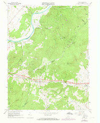
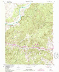
1966 Map of Linden
USGS Topo · Published 1973About this map
The Shenandoah River snakes through the northwest corner of this terrain, where the river-valley settlements of Howellsville and Morgan Ford meet the rising slopes of the Blue Ridge. This mid-1960s survey, updated with 1972 aerial revisions, illustrates the critical transportation corridor through Manassas Gap. Here, the Southern Railway and primary roadways parallel Goose Creek to connect Linden and Markham.
Find a feature on this map
50 named features on this map. Tap any name to fly to it.
Don’t see what you’re looking for? This feature index may not catch every label — zoom into the map to look around manually.
Map Details
Editions of this 1966 Linden Map
5 editions found
Other maps of this area

1884 · Harpers Ferry
USGS Topo · 1:125,000

1891 · Harpers Ferry
USGS Topo · 1:125,000

1893 · Luray
USGS Topo · 1:125,000

1893 · Harpers Ferry
USGS Topo · 1:125,000

1894 · Warrenton
USGS Topo · 1:125,000

1894 · Winchester
USGS Topo · 1:125,000

1905 · Luray
USGS Topo · 1:125,000

1916 · Berryville
USGS Topo · 1:62,500

1938 · Winchester
USGS Topo · 1:48,000

1939 · Front Royal
USGS Topo · 1:48,000