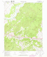
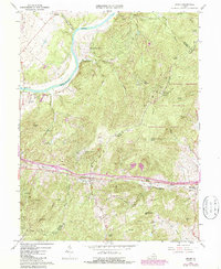
1966 Map of Linden
USGS Topo · Published 1980About this map
The Shenandoah River winds through the northwestern corner of this 1966 topographic survey, defining the valley's edge below the prominent ridge of the Blue Ridge. This landscape is centered on the mountain passage at Manassas Gap, where the Southern railroad and highway corridor connect the Piedmont to the Shenandoah Valley. Settlement is concentrated at Linden and Markham, while mountain hollows like Wildcat Hollow and Snake Hollow showcase the area's rural character before extensive modern development.
Find a feature on this map
49 named features on this map. Tap any name to fly to it.
Don’t see what you’re looking for? This feature index may not catch every label — zoom into the map to look around manually.
Map Details
Editions of this 1966 Linden Map
5 editions found
Other maps of this area

1884 · Harpers Ferry
USGS Topo · 1:125,000

1891 · Harpers Ferry
USGS Topo · 1:125,000

1893 · Luray
USGS Topo · 1:125,000

1893 · Harpers Ferry
USGS Topo · 1:125,000

1894 · Warrenton
USGS Topo · 1:125,000

1894 · Winchester
USGS Topo · 1:125,000

1905 · Luray
USGS Topo · 1:125,000

1916 · Berryville
USGS Topo · 1:62,500

1938 · Winchester
USGS Topo · 1:48,000

1939 · Front Royal
USGS Topo · 1:48,000