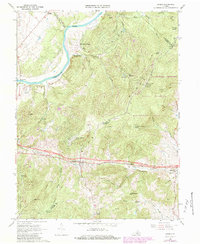
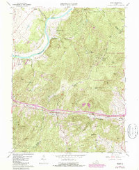
1966 Map of Linden
USGS Topo · Published 1984About this map
Blue Ridge terrain and the strategic passage of Manassas Gap define this portion of Warren County during the mid-1960s. The Southern railway and state roads parallel Manassas Run, connecting the settlements of Linden, Belle Meade, and Markham along a vital east-west corridor. To the north, the Shenandoah River winds past Shenandoah Farms and Howellsville, where local landmarks like the Morgan Ford and Aspen Hill Airstrip reflect the varied uses of the riverfront flats.
Find a feature on this map
56 named features on this map. Tap any name to fly to it.
Don’t see what you’re looking for? This feature index may not catch every label — zoom into the map to look around manually.
Map Details
Editions of this 1966 Linden Map
5 editions found
Other maps of this area

1884 · Harpers Ferry
USGS Topo · 1:125,000

1891 · Harpers Ferry
USGS Topo · 1:125,000

1893 · Luray
USGS Topo · 1:125,000

1893 · Harpers Ferry
USGS Topo · 1:125,000

1894 · Warrenton
USGS Topo · 1:125,000

1894 · Winchester
USGS Topo · 1:125,000

1905 · Luray
USGS Topo · 1:125,000

1916 · Berryville
USGS Topo · 1:62,500

1938 · Winchester
USGS Topo · 1:48,000

1939 · Front Royal
USGS Topo · 1:48,000