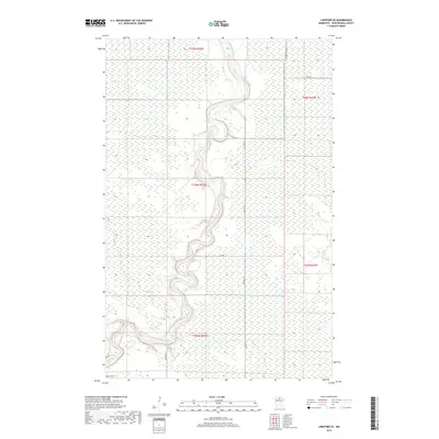
2019 Map of Lindford SE
USGS Topo · Published 2019About this map
The Big Fork River carves a winding course through the northern Minnesota wilderness in this 2019 survey of Koochiching County. This landscape is defined by its extensive wetlands and the intricate loops of the river, which snakes across township lines such as t156n r25w. The drainage patterns are further detailed by the inclusion of the Bear River, which enters the area from the east. While the terrain remains largely undeveloped, a sparse network of forest and county roads provides access to the interior. Notable corridors include the straight-line path of Radar Rd in the south and Co Hwy 13, which tracks north-south through the center of the quadrangle. These routes, along with Ben Lynn Rd, reflect the modern infrastructure used for timber management and land access in this remote portion of the state.
Find a feature on this map
14 named features on this map. Tap any name to fly to it.
Don’t see what you’re looking for? This feature index may not catch every label — zoom into the map to look around manually.
Map Details
Editions of this 2019 Lindford SE Map
This is the sole edition of this map. No revisions or reprints were ever made.
Other maps of this area

1919 · Happy Land
USGS Topo · 1:62,500

1919 · M
USGS Topo · 1:62,500

1919 · Margie
USGS Topo · 1:62,500

1943 · Lindford
USGS Topo · 1:62,500

1954 · International Falls
USGS Topo · 1:250,000

1957 · International Falls
USGS Topo · 1:250,000

1958 · International Falls
USGS Topo · 1:250,000

1970 · Littlefork SW
USGS Topo · 1:24,000
1970 · Lindford SW
USGS Topo · 1:24,000
1970 · Lindford
USGS Topo · 1:24,000