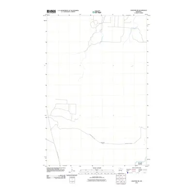
2010 Map of Lindford SW
USGS Topo · Published 2010About this map
Big Fork River meanders through this portion of Koochiching County, anchoring a landscape defined by forest roads and remote outposts. The southern edge of the map features Ben Linn Landing, a point of river access that reflects the area's historical reliance on water routes for transport and recreation. Moving north from the river, Hendrickson Camp Rd provides the primary passage toward Hendrickson Camp, while Toumey Williams Rd marks the western boundary. This survey depicts the region as it existed in 2010, illustrating a sparsely populated territory where infrastructure is primarily designed to facilitate timber access and seasonal residency rather than dense settlement.
Find a feature on this map
5 named features on this map. Tap any name to fly to it.
Don’t see what you’re looking for? This feature index may not catch every label — zoom into the map to look around manually.
Map Details
Editions of this 2010 Lindford SW Map
This is the sole edition of this map. No revisions or reprints were ever made.
Other maps of this area

1919 · Lundgren
USGS Topo · 1:62,500

1919 · I
USGS Topo · 1:62,500

1919 · Margie
USGS Topo · 1:62,500

1943 · Lindford
USGS Topo · 1:62,500

1954 · Roseau
USGS Topo · 1:250,000

1954 · International Falls
USGS Topo · 1:250,000

1957 · Roseau
USGS Topo · 1:250,000

1957 · International Falls
USGS Topo · 1:250,000

1958 · International Falls
USGS Topo · 1:250,000

1958 · Roseau
USGS Topo · 1:250,000