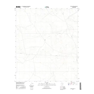
2016 Map of Lindley Ranch
USGS Topo · Published 2016About this map
Lindley Ranch sits within a sparsely populated expanse of West Texas, characterizing the vast ranching and energy landscapes of Loving County. This 2016 survey shows a territory defined more by its industrial and access roads than by dense settlement. The map documents the layout of local infrastructure such as Port Road 3015, Co Rd 300, and Reeves Co 440, which facilitate movement across the arid terrain. The sparse distribution of named features highlights the isolated nature of this region, where the historical ranching economy intersects with modern logistical routes.
Find a feature on this map
4 named features on this map. Tap any name to fly to it.
Don’t see what you’re looking for? This feature index may not catch every label — zoom into the map to look around manually.
Map Details
Editions of this 2016 Lindley Ranch Map
This is the sole edition of this map. No revisions or reprints were ever made.
Other maps of this area

1931 · Orla
USGS Topo · 1:62,500

1954 · Pecos
USGS Topo · 1:250,000

1957 · Pecos
USGS Topo · 1:250,000

1961 · Mentone
USGS Topo · 1:24,000

1961 · Anderson Ranch
USGS Topo · 1:24,000

1961 · Orla SE
USGS Topo · 1:24,000

1961 · Lindley Ranch
USGS Topo · 1:24,000

1961 · Narrow Bow Draw
USGS Topo · 1:24,000

1968 · Orla NE
USGS Topo · 1:24,000

1969 · Kyle Ranch
USGS Topo · 1:24,000