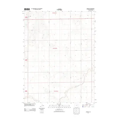
2013 Map of Lindon NE
USGS Topo · Published 2013About this map
Lindon Oil Field sits in the northwest corner of this high plains landscape, indicating the specialized energy industry that punctuates the rural landscape of Washington County. The topography is defined by the gradual drainage of Gordon Creek in the southern portion of the sheet, where the land breaks into subtle draws and depressions. A rigid grid of county thoroughfares, including Co Road AA and Co Road 11, organizes the territory into a patchwork of section lines typical of the Public Land Survey System. Us-36 E serves as the primary east-west artery, connecting this quiet agricultural and industrial area to the wider region. This survey documents the intersection of natural watercourses and the human-imposed geometry of resource extraction and transportation in the early 21st century.
Find a feature on this map
21 named features on this map. Tap any name to fly to it.
Don’t see what you’re looking for? This feature index may not catch every label — zoom into the map to look around manually.
Map Details
Editions of this 2013 Lindon NE Map
This is the sole edition of this map. No revisions or reprints were ever made.
Other maps of this area

1954 · Limon
USGS Topo · 1:250,000

1957 · Limon
USGS Topo · 1:250,000

1958 · Limon
USGS Topo · 1:250,000

1973 · Dry Gulch
USGS Topo · 1:24,000

1973 · Lindon NE
USGS Topo · 1:24,000

1973 · Antelope Creek SE
USGS Topo · 1:24,000

1973 · Lindon SW
USGS Topo · 1:24,000

1973 · Lindon
USGS Topo · 1:24,000

1973 · Shaw
USGS Topo · 1:24,000

1977 · Thurman
USGS Topo · 1:24,000