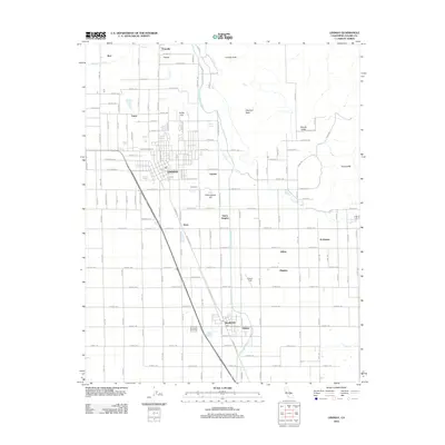
2012 Map of Lindsay
USGS Topo · Published 2012About this map
The Lindsay and Strathmore communities anchor this agricultural and residential landscape in Tulare County, defined by the engineered path of the Friant-Kern Canal and the foothills of the Sierra Nevada. The map illustrates a grid of numbered avenues and named streets that integrate small settlements like Tonyville, Lucca, and Stout with the central hubs. Notable landmarks include the Lindsay Golf Course and the Olive Cem, while the industrial and aviation history of the region is marked by Eckert Field. The terrain transitions from the valley floor toward the eastern elevations of Lindsay Peak, Elephant Back, and the Rocky Hills, with many residential developments concentrated around Sierra Heights and Chrysoprase Hill. This 2012 survey provides a clear view of the modern layout of these citrus-belt towns, showing the proximity of quiet residential streets like W Mariposa St and E Honolulu St to the regional infrastructure.
Find a feature on this map
68 named features on this map. Tap any name to fly to it.
Don’t see what you’re looking for? This feature index may not catch every label — zoom into the map to look around manually.
Map Details
Editions of this 2012 Lindsay Map
This is the sole edition of this map. No revisions or reprints were ever made.
Other maps of this area

1904 · Kaweah
USGS Topo · 1:125,000

1909 · Kaweah
USGS Topo · 1:125,000

1925 · Rocky Hill
USGS Topo · 1:31,680

1926 · Exeter
USGS Topo · 1:31,680

1927 · Cairns Corner
USGS Topo · 1:31,680

1927 · Rocky Hill
USGS Topo · 1:31,680

1928 · Woodville
USGS Topo · 1:31,680

1928 · Lindsay
USGS Topo · 1:31,680

1929 · Porterville
USGS Topo · 1:31,680

1937 · Kaweah
USGS Topo · 1:125,000