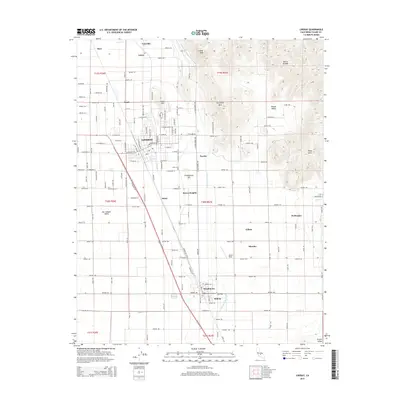
2015 Map of Lindsay
USGS Topo · Published 2015About this map
The agricultural landscape of the San Joaquin Valley meets the rising foothills of the Sierra Nevada in this 2015 survey. Centered on the city of Lindsay, the map illustrates a complex network of water management essential to the region's citrus industry, most notably the Friant-Kern Canal and the Lindsay-Strathmore Irrigation Ditch. These man-made arteries contrast with natural drainages like Lewis Creek and Frazier Creek. To the east, the terrain becomes more varied with landmarks such as Lindsay Peak, Elephant Back, and the Rocky Hills overlooking Round Valley. Smaller communities and named locales including Strathmore, Tonyville, Sierra Heights, and El Mirador are connected by a grid of numbered avenues and local roads. Historical points of interest include the Olive Cemetery and the Eckert Field airstrip, while family-named features like Todds Hill and Chrysoprase Hill anchor the local geography.
Find a feature on this map
85 named features on this map. Tap any name to fly to it.
Don’t see what you’re looking for? This feature index may not catch every label — zoom into the map to look around manually.
Map Details
Editions of this 2015 Lindsay Map
This is the sole edition of this map. No revisions or reprints were ever made.
Other maps of this area

1904 · Kaweah
USGS Topo · 1:125,000

1909 · Kaweah
USGS Topo · 1:125,000

1925 · Rocky Hill
USGS Topo · 1:31,680

1926 · Exeter
USGS Topo · 1:31,680

1927 · Cairns Corner
USGS Topo · 1:31,680

1927 · Rocky Hill
USGS Topo · 1:31,680

1928 · Woodville
USGS Topo · 1:31,680

1928 · Lindsay
USGS Topo · 1:31,680

1929 · Porterville
USGS Topo · 1:31,680

1937 · Kaweah
USGS Topo · 1:125,000