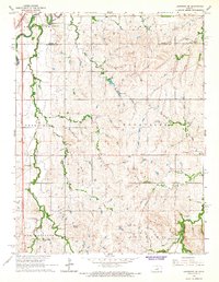
1965 Map of Lindsborg SE
USGS Topo · Published 1966About this map
The Smoky Hill River winds through the northwestern corner of this Kansas landscape, where the Union Pacific Railroad and Missouri Pacific Railroad converge near the Saline and McPherson County line. This mid-1960s survey reveals a rural territory defined by traditional townships and scattered local landmarks, including the Smoky Hill Cem and Zion Cem. The topography is marked by numerous drainages such as Kentucky Creek, Sharps Creek, and North Gypsum Creek, which carve through the terrain between established areas like Bonaville and New Gottland. Small-scale industrial activity is evidenced by several Sandpits located south of the Radio Tower. The inclusion of the residential pocket at Alliance Acres and its adjacent Alliance Acres Park shows the localized development occurring amidst the broader agricultural and hydraulic features like Gas Lake.
Find a feature on this map
23 named features on this map. Tap any name to fly to it.
Don’t see what you’re looking for? This feature index may not catch every label — zoom into the map to look around manually.
Map Details
Editions of this 1965 Lindsborg SE Map
3 editions found
Other maps of this area

1889 · Newton
USGS Topo · 1:125,000

1889 · Abilene
USGS Topo · 1:125,000

1891 · Hutchinson
USGS Topo · 1:125,000

1892 · Salina
USGS Topo · 1:125,000

1893 · Hutchinson
USGS Topo · 1:125,000

1894 · Newton
USGS Topo · 1:125,000

1894 · Abilene
USGS Topo · 1:125,000

1942 · Salina
USGS Topo · 1:125,000

1955 · Assaria
USGS Topo · 1:24,000

1955 · Smolan
USGS Topo · 1:24,000