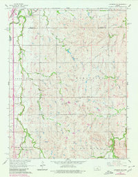
1965 Map of Lindsborg SE
USGS Topo · Published 1980About this map
The Smoky Hill River meanders through the northwest corner of this landscape, marking the transition between the Smoky View and Smoky Hill townships. This agricultural region of McPherson County is characterized by a dense grid of fence lines and sections, where rural life centered on small landmarks like Zion Cem and the Smoky Hill Cem. The transportation network is anchored by the Union Pacific Missouri Pacific rail line and the corridor of Interstate 81, which cuts through the western edge of the area.
Find a feature on this map
22 named features on this map. Tap any name to fly to it.
Don’t see what you’re looking for? This feature index may not catch every label — zoom into the map to look around manually.
Map Details
Editions of this 1965 Lindsborg SE Map
3 editions found
Other maps of this area

1889 · Newton
USGS Topo · 1:125,000

1889 · Abilene
USGS Topo · 1:125,000

1891 · Hutchinson
USGS Topo · 1:125,000

1892 · Salina
USGS Topo · 1:125,000

1893 · Hutchinson
USGS Topo · 1:125,000

1894 · Newton
USGS Topo · 1:125,000

1894 · Abilene
USGS Topo · 1:125,000

1942 · Salina
USGS Topo · 1:125,000

1955 · Assaria
USGS Topo · 1:24,000

1955 · Smolan
USGS Topo · 1:24,000