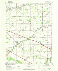
1969 Map of Lindsey
USGS Topo · Published 1971About this map
The village of Lindsey serves as the focal point of this Northwest Ohio landscape, situated at a junction of rail and water where the Penn Central tracks cross Muddy Creek. The area is defined by its drainage into the Portage River to the north, with a complex network of tributaries like Wolf Creek and Ninemile Creek carving through the agricultural townships. This late-1960s snapshot shows a region transitioning into the modern era, as the massive Ohio Toll Road Turnpike slices diagonally across the traditional grid of country roads, bypassing older crossroads like Hessville and Kingsway. Local genealogy is well-preserved through markers like the Roose Cem and the Township Sch in Lindsey, while the appearance of a Landing Strip and a Sewage Disposal Pond indicate the growing infrastructure needs of the post-war period.
Find a feature on this map
65 named features on this map. Tap any name to fly to it.
Don’t see what you’re looking for? This feature index may not catch every label — zoom into the map to look around manually.
Map Details
Editions of this 1969 Lindsey Map
This is the sole edition of this map. No revisions or reprints were ever made.
Other maps of this area

1900 · Maumee Bay
USGS Topo · 1:62,500

1900 · Oak Harbor
USGS Topo · 1:62,500

1901 · Fremont
USGS Topo · 1:62,500

1901 · Elmore
USGS Topo · 1:62,500

1903 · Fremont
USGS Topo · 1:62,500

1903 · Elmore
USGS Topo · 1:62,500

1935 · Genoa
USGS Topo · 1:24,000
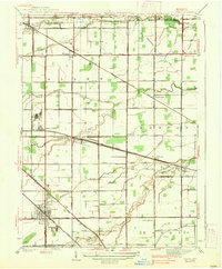
1938 · Genoa
USGS Topo · 1:31,680
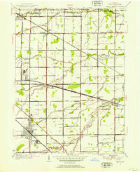
1952 · Genoa
USGS Topo · 1:24,000

1952 · Oak Harbor
USGS Topo · 1:24,000