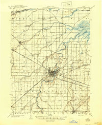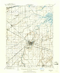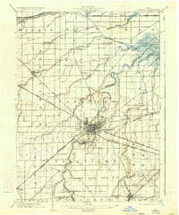
1903 Map of Fremont
USGS Topo · Published 1934About this map
The Sandusky River carves a deep, winding path through this corner of Northwest Ohio, serving as the central artery for the thriving industrial and transit hub of Fremont. At the start of the twentieth century, this landscape was defined by an exceptionally dense web of competing rail lines, including the Wheeling and Lake Erie and several divisions of the Lake Shore and Michigan Southern. These tracks connect the county seat to outlying settlements like Ballville, Lindsey, and Hessville, while specialized routes like the Western Fremont and Ballville Electric highlight the era's reliance on interurban trolley systems. To the northeast, the terrain opens into the marshy expanses of Muddy Creek Bay and the Little Portage River, while southern sections of the map preserve the distinct boundaries of an Indian Reservation and the Eastern Boundary line, marking remnants of the region's earlier territorial history.
Find a feature on this map
48 named features on this map. Tap any name to fly to it.
Don’t see what you’re looking for? This feature index may not catch every label — zoom into the map to look around manually.
Map Details
Editions of this 1903 Fremont Map
2 editions found